Itinerary Detail
Itinerary "A" - 8 days / 7 nights
Day 1 - Wednesday
FLY TO GALAPAGOS & BOARD THE M/Y GRAND DAPHNE
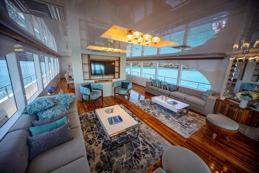
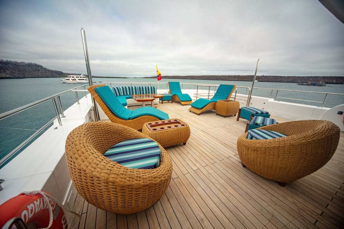
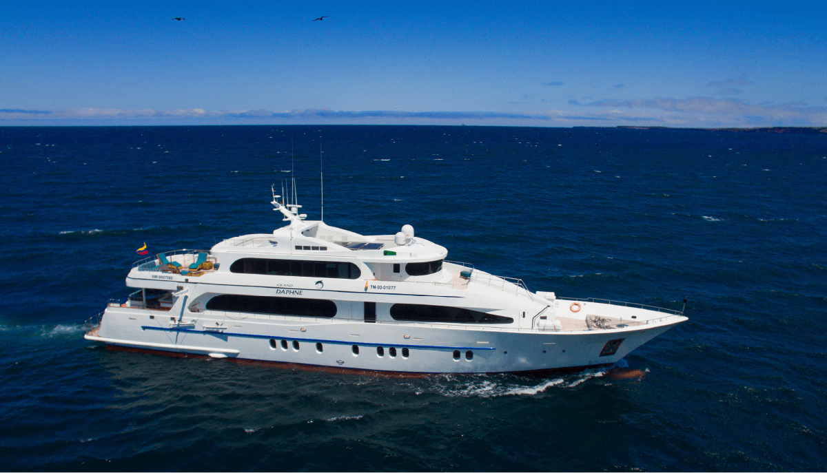
One of our Guides will take you to the Quito airport in time for your flight to Galapagos which is typically in the morning and arrives to Galapagos before noon. Transfer to the luxury class yacht M/Y GRAND DAPHNE (by Spirit)
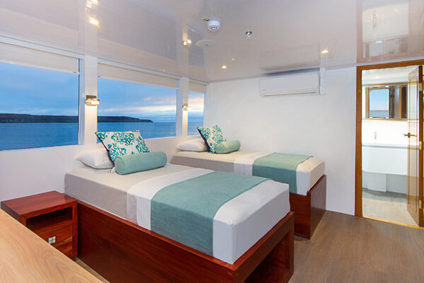
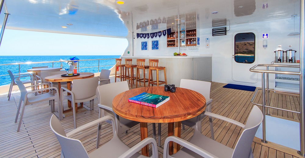
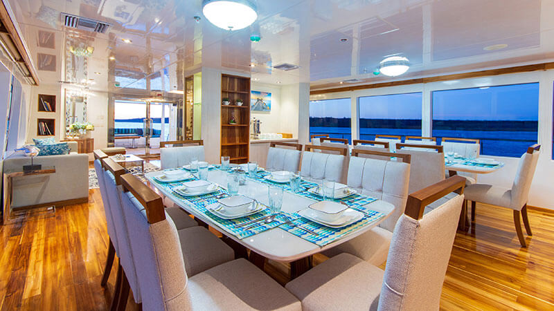
Begin your 7-night cruise through Darwin’s “Enchanted Islands”. Accommodations will be in seven staterooms and one main deck master suite (double occupation). All cabins are spacious and feature a private bath/shower and air-conditioning. All meals, lectures and shore excursions are included.
All of our wildlife excursions and cultural programs are led by category by Naturalist Guides category III, with years of experience in interpreting nature and leading groups of all types of interest in the Galapagos Islands. PM: Bachas Beach – Santa Cruz Island. It’s a site full of sun, beaches and water, where we can find the remains of barges that sank and had once been used by the United States when they had an airbase on the island of Baltra during World War II. That is why the beach is called “Bachas” because the word “barges” in English pronunciation was hard for local people, so in the attempt to maintain the same word, the locals came up with the Spanish phonetics. We shall walk for about 10 minutes toward the coastal ponds that can be found at both tips of the beach, because here we can usually find flamingos feeding. (L, D)
Day 2 - Thursday
CRUISING THE GALAPAGOS ISLANDS
AM: Rabida Island Also known as Jervis Island in English, Rabida is one of the most diverse in terms of volcanic activity as it lies at the very heart of the archipelago’s volcanic origin. It is an island comprised of lava poured out of scoria cones, which are very rich in iron oxide and magnesium (typical of Galapagos basaltic lava); that when exposed and as it rusts, gives the island its astounding, unearthly reddish color. Rabida has an abundance of landscapes and marine life. The trail for visiting the site is somewhat short, requiring about 45 minutes of walking. We can also go around the shoreline in a dinghy to spot fur seals, pelicans, blue-footed boobies and Nazca boobies. Excellent place for swimming and snorkeling, you could see white tipped sharks, rays and sea lions, and other different species.
PM: Espumilla Bay – Santiago Island. This is an amazing location featuring the remains of an eroded shoreline that is home to seabirds, fur seals, and playful sea lions. Its different shapes have been made throughout and erosion process of the salty waves and wind. Espumilla beach is a white-sandy front located in James Bay very popular among visitors. Espumilla is a typical Ecuadorian dessert made of fruit and eggs which consistency is very similar to a foamy dessert which can also describe the foamy waves of this site. There are mangroves and a small palo santo forest that lead to salty lagoons that are home to wading birds such as flamingoes. (B, L, D)
Day 3 - Friday
CRUISING THE GALAPAGOS ISLANDS
AM: Tagus Cove – Isabela Island Tagus Cove is located on the Northwestern coast of Isabela. It is a historical site visited by Charles Darwin in 1835, where graffiti has been carved into the rock walls by visitors over the past centuries; this happened just before the Galapagos National Park was established in 1959- 1960. This cove was a hideout for whalers and pirates, as it is protected by the surf and is also a perfect place to anchor. The name of the site dates back to 1814 when it was visited by a British ship, The Tagus, which had anchored there in search of giant tortoises to be used as food supply on the boat. We will return by the same path for an hour dinghy ride along a shoreline full of marine wildlife. Here, we will admire a variety of seabirds, such as blue-footed booby, brown noddy, terns, flightless cormorant and Galapagos penguins depending on the season. The Galapagos penguins are only 1.4 ft. tall (35 cm) and are the only penguin species in the world living in the northern hemisphere, that is, along the Equator. They are monogamous and lay their eggs in small cracks of lava, on the lower parts of the island near the shoreline not reached by the ocean’s water. The population of penguins on the islands is about 700 pairs, most of which live on the western portion of Isabela; others are cattered further south of the island. Along theTagus, we can observe sea turtles, eagle, rays, sea lions and, if we’re lucky, dolphins swimming in the vicinity. Here, snorkeling is allowed. Once we leave Tagus Cove, we navigate into the Bolivar Channel for excellent opportunities for whale and dolphin watching.!
PM: Espinoza Point – Fernandina Island Espinosa Point is the only spot that we visit on Fernandina, and from it, we can see the island of Isabela across the Bolívar Channel, an area that boasts some of the highest diversity of endemic sea fauna in the Galapagos. Technically, it is rich in “marine upwelling”, which directly or indirectly affects the entire food chain, bringing a wealth of wildlife to this particular western zone of the archipelago. The upwelling occurs when the cold waters of the Cromwell Current, laden with nutrients, meets the island. This brings large amounts of plankton to the surface providing a wealth of food where a variety of species can take advantage of. (B, L, D)
Day 4 - Saturday
CRUISING THE GALAPAGOS ISLANDS
AM: Vicente Roca Point – Isabela Island. Vicente Roca Point has great deep-water snorkeling at one of the richest marine havens on Earth (Bolivar Channel). We take a dinghy ride along the coast to observe a great diversity of sea and coastal birds; Nazca and blue-footed boobies, noddies, brown pelicans, penguins, flightless cormorants. The upwelling of cold-water currents in this part of the Galapagos gives rise to an abundance of marine life.
PM: Albemarle Point – Isabela Island Punta Albemarle is the highest point on the northern part of Isabela, the location consists of 2 areas, a mangrove area best covered in a Dinghy ride due to its formed creeks & channels, & a former radar base from American troops that date back to World War II located near the beach. The Panga Ride boosts rich marine life, sea birds, great amount of flightless cormorants & the largest marine iguana found in the Archipelago. (B, L, D)
Day 5 - Sunday
CRUISING THE GALAPAGOS ISLANDS
AM: Puerto Egas – Santiago Island. Egas Port named in honor of Jorge Egas, an entrepreneur who explored the island in the 1930s and opened a salt mine at the foothill of “Sugarloaf” Volcano. The site was actually visited in 1835 by the HMS Beagle and Charles Darwin, who described in his journals, a group of Spaniards salting tortoise meat with the salt extracted from the area.
The first part of the trail is comprised of volcanic ash (a tuff cone) and the other half of the trail is partially uneven terrain, comprised of volcanic basaltic rock that lounges the shoreline. PM: Sullivan Bay – Santiago Island This visitor site is located at the southeastern portion of Santiago Island and represents a great important geologic interest; it features extensive lava flows which are believed to have been formed during the last quarter of the 19th century. The area is covered by Pahoehoe lava flows (Pahoehoe wich means in Polynesian language “easy to walk”); this type of lava is rare to the rest of the world but is common to the volcanoes of the Galapagos Islands and Hawaii, as they share the same volcanic origin. You can see the path of lava flow as well as the various igneous rock structures formed from varying rates of flow, temperature of formation and pressure. Visitors can also find pioneer plants and “hornitos”, little ovens formed when bubbles escape from hot lava to form minivolcanoes. (B, L, D)
Day 6 - Monday
CRUISING THE GALAPAGOS ISLANDS
AM: Bartolome Island The most iconic place in the Galapagos. Located at the center of the archipelago, Bartolome is one of the most frequently visited sites of all the islands. The highest point is only 374 ft (114 m) above sea level and it is separated from the island of Santiago by Sullivan Bay. The island has a surface area of 0.74 mi (1.2 km) It is an excellent site for snorkeling, filled with the breathtaking volcanic landscapes that make this corner of the world so unique. We have two landing possibilities: a dock and a beach. The dock, made out of lava and concrete, soon turns into a wooden staircase built to avoid erosion and consists of 372 steps. It takes us to the island’s summit, where we find what probably constitutes the most photographed site in the Galapagos: Pinnacle Rock.
PM: Chinese Hat Like most of Galapagos, Sombrero Chino is volcanic in origin. Ages ago, the volcano on nearby Santiago Island erupted, spewing rocks and forming what is known as a “spatter cone.” It’s essentially a mountain made of lava and rocks from an erupting volcano. Over time, the mountain was eroded away and the ocean carved a channel between the Santiago Volcano and its spatter cone child. Lava floes on Sombrero Chino are more recent and have nothing to do with its formation. (B, L, D)
Day 7 - Tuesday
CRUISING THE GALAPAGOS ISLANDS
AM: North Seymour Island. It is a fascinating place to see blue-footed boobies nesting and frigatebirds colonies. This is perhaps one of the busiest tourists destinations on the Archipelago, right next to Baltra Island (where the airport is located) and not far from Santa Cruz. North Seymour is a fascinating place with open nesting grounds of blue-footed Boobies and the archipelago’s largest colonies of Great and magnificent Frigate birds. You will also encounter sea lions, swallow-tailed Gulls and on a lucky day, you might even come across a Galapagos Snake. North Seymour is a tectonic uplift. In terms of its geology, it is the result of the earth’s crust uplifting from below sea level, and this has created a potpourri of geologic formations. This phenomenon causes the island cliffs to drop dramatically into the ocean. Crustaceans, reptiles and plant species can be found here, many of which inhabit the intertidal zone (or foreshore).
PM: Puerto Ayora Founded in 1959, the Charles Darwin Foundation is dedicated to the preservation and conservation of the Galapagos Islands and the animals and plants that live there. They have many projects going on at any given time, and may include programs such as removal of introduced species, monitoring the health of certain animal or plant populations, helping set fishing limits and more. The foundation relies on donations to support their activities. It is named for Charles Darwin, the famed British naturalist who visited the islands in 1835 aboard the HMS Beagle. He later made the Islands famous by using the Galapagos finches to illustrate his Theory of Evolution. (B, L, D)
Day 8 - Wednesday
FLIGHT BACK HOME
AM: Highlands of Santa Cruz island Today you will visit Santa Cruz, the second largest island in the Galapagos. Afterward you’ll head up into the highlands for a total change of scenery. Beginning at the coast you will travel across Santa Cruz through the agricultural region and into the misty forests.
This is a lush humid zone containing miconia bushes, scalesia and inactive volcanic cones. Santa Cruz has more endemic plants than any of the other islands and you are likely to see Galapagos giant tortoises in their natural habitat and perhaps even the bright red feathers of a vermillion flycatcher! Transfer to the Baltra airport for your flight back to Quito or Guayaquil. Arrive to Quito and connect with your international flight or take an extension to other amazing parts of Ecuador with us. (B) End of our services.
-
Ecuador Address: Checoslovaquia E9-95, Eveliza Plaza Tower, Office: 404
Quito - Ecuador - 347-721-9006
- spirit@galapagosspirit.com
Quick Links
Subscribe our newsletter
Subscribe to know about the best promotions and best tours we have for you. You will be able to find out the latest news and interesting facts about destinations and offers.